
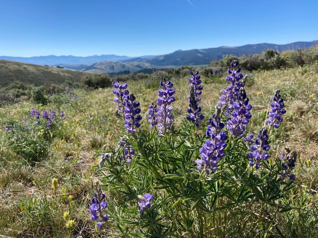
On a recent camping trip to Idaho and Montana, we drove through Lemhi Pass. Approaching from the Montana side on a hot, clear June day, we wandered around the summit, marveled at the sweeping views, and visited the Sacagawea Memorial. Mid-week, we were the only visitors and could take our time to soak up the history and majesty of our surroundings.
The Shoshone Indians and other tribes commonly crossed what later became known as the Continental Divide. Their footsteps and horse hooves created a clear trail for Lewis and Clark to follow in 1805. The trail through the rugged Bitterroot Range of the Rocky Mountains is a passageway between the Salmon River Valley to the west, and Horse Prairie to the east. Later, mountain men and fur traders called it “North Pass.”
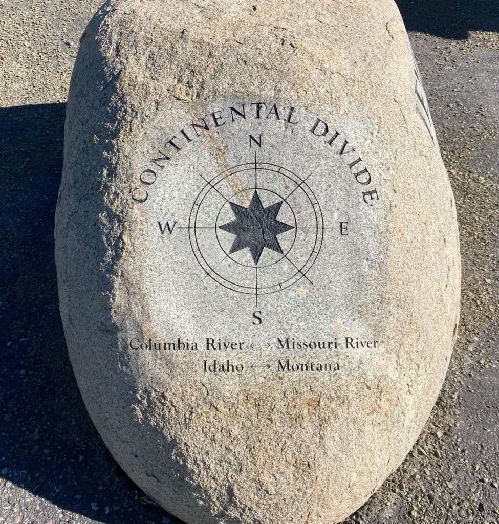
A high mountain pass in the Beaverhead Mountains and part of the Bitterroot Range in the Rocky Mountains, Lemhi Pass is within Salmon-Challis National Forest. The pass lies on the Montana-Idaho border on the continental divide, at an elevation of 7,373 feet above sea level.
The name Lemhi dates back to 1855 when Mormon pioneers built Fort Limhi, named after a king in the Book of Mormon. Later the spelling was changed to Lemhi and the name remained with the land and its people, the Lemhi Shoshone.
Falling rain creates an interesting phenomena in this area. Rain falling east of Lemhi Pass drains to the Missouri and later the Mississippi River, then into the Gulf of Mexico. However, rain falling west of the pass drains into the Salmon, Snake and Columbia Rivers and eventually into the Pacific Ocean.
Lemhi Pass is a spectacular place. If you have an opportunity to visit, don’t pass up this high-level delight.
Loved this, Mary. Thanks for sharing the history of the Lemhi Pass. One of my favorite places is the Bitterroot range. Keep on sharing! I sure enjoy your journeys.
Thank YOU, Carmen. I love to share our trips, too. It makes our travels even richer when I research the areas.