
 About this time of year, my husband Bruce and I begin to dream about where we might go for our summer vacation and reminisce about past trips. Yukon Territory is high on our list of special trips taken. Canada’s Yukon Territory is still as wild as it sounds. Look at this region on a map, and you’ll find precious few roads. The main highways–some paved but many still gravel–are well maintained.
Driving this loop tour, we often traveled for more than a hundred miles before encountering another vehicle. And this was in August–the peak of Yukon Territory’s tourist season. If you like privacy, you will love the Yukon, where it’s said that caribou outnumber the people five to one.
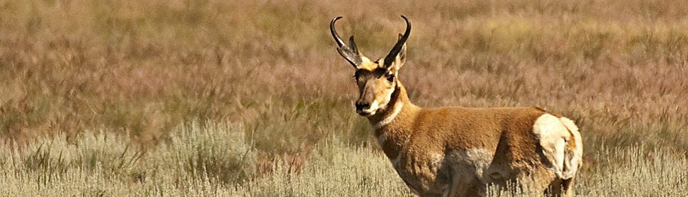
We were thrilled to see an abundance of waterfowl, deer, bear, caribou, stone sheep, a variety of squirrels; a pair of red foxes; a cow moose and her calf.
The number of lakes in the Territory is astounding. These sparkling jewels often are surrounded by shimmering aspen trees. We saw forests of white spruce, sometimes interspersed with the more scraggily black spruce. The trees are small due to a short growing season.
As we traveled around Yukon Territory, we noted the “On Yukon Time” icons, signs of special attractions worthy of visitors’ attention, an invitation to slow down, explore and enjoy.
Our 750-mile loop, two-week tour began at Watson Lake. From there we traveled northwest on the Campbell Highway to Carmacks. We then headed south on the Klondike Highway through Whitehorse, then drove southeast on the Alaska Highway from Whitehorse back to Watson Lake. Here are some of the highlights:
Robert Campbell Highway was completed in 1968 and closely follows sections of the fur trade route established by Robert Campbell. In the 1840s, Campbell explored this region and named virtually every major river in the Yukon. The highway bearing his name parallels several major waterways, including the Frances, Finlayson, and Pelly rivers. The distance from Watson Lake to Carmacks along this route is 362 miles (583 kilometers).
The communities of Ross River and Faro, situated along the Campbell Highway, obviously were built to withstand the winter more than provide visual aesthetics. Ross River, population approximately 350, is located at the junction of the Ross and the Pelly rivers. From there you can walk across a suspension foot-bridge that spans the Pelly River.
We found very few people inhabiting Faro, the next town along the Campbell Highway. Apparently, this town, named after a card game, comes to life when the nearby lead-zinc mines are active, but when we visited, they were closed.
An RV campground is located across the street from Faro’s Campbell Region Interpretive Tourist Information Centre. The center is well worth visiting for its historical displays. Faro is ideally situated for wildlife viewing and hiking, not to mention golf: The town offers an unusual nine-hole urban course that plays through the town’s green spaces.
Klondike Highway. The Campbell Highway terminates just north of Carmacks. We turned south on the Klondike Highway (Route 2) and traveled to the town of Carmacks, a good place to stop for provisions and services.
Carmacks was named after George Washington Carmack, who set up a trading post in the 1890s. Carmacks’s post went bust in 1896, so he settled elsewhere. It was a good thing he did. He later found more than a ton of gold in Bonanza Creek, and word of his discovery launched the Klondike Gold Rush.
From Carmacks we traveled south on the Klondike Highway toward Whitehorse. We stopped for the night at Lake LaBerge, named after Western Union Telegraph explorer, Michael LaBerge of Quebec. Our lakeside campsite was secluded and serenely quiet. As we sat on Lake LeBerge’s shore, Bruce recited from memory Robert W. Service’s wonderful poem, “The Cremation of Sam McGee,” a tale that brings Yukon’s rugged history to life.
Only 15 miles south of Lake LeBerge via the Klondike Highway is Whitehorse, Yukon Territory’s capital city since 1953. Whitehorse was named for turbulent, frothy rapids on the Yukon River that resemble the flowing manes of white horses. A hydroelectric dam on the river has since harnessed the “horses,” making the waters more placid.
In addition to provisions and several RV supply and repair shops, the city offers opportunities to view architectural, art, and gold-rush memorabilia.
Alaska Highway. The final part of this loop tour involves taking the Klondike Highway to Jake’s Corner, and then turning east toward Watson Lake on Route 1, the Alaska Highway.
The Alaska Highway was built jointly by military and civilian personnel from Canada and the United States, and was to serve as an important access road to Alaska. It is now mostly paved and, compared to yesteryear, easy to drive.
The Alaska Highway dips briefly into British Columbia, then continues on to Watson Lake, where the loop is completed. For more information about the Yukon Territory, visit www.touryukon.com or call 1-800-661-0494.
Tips for Yukon Travel
● Place a mesh screen over your radiator to protect your vehicle from rocks and to filter out insects. Consider protecting your towed car with a rock shield.
● Be sure your spare tire is reliable and ready to install.
● Bring plenty of insect repellent. To keep mosquitoes at bay, wear lightweight pants and tops with long sleeves.
● In August, we found nights can be cool, but daytime temperatures quite warm. Be prepared for these extremes.
● Take advantage of all fuel stops. In some cases, there may be long distances between gas stations.
Camping in The Yukon: Many privately operated campgrounds are available in Yukon Territory, but we stayed exclusively at the government campgrounds, and found them to be delightful and reasonably priced. You must purchase a camping permit before you arrive at the campground. Permits are readily available at visitor reception centers as well as at retail outlets throughout the Yukon.
Most Yukon government campgrounds do not offer hookups. Most locations do have picnic tables, campfire pits, firewood and at least one picnic shelter. Outhouses and hand-pumped water are the norm. At many of the campgrounds, signs indicate that the water should be boiled before being consumed. For your convenience, you might want to carry your own drinking water if you choose to stay at these camps.
.
Hello There. I found your blog using msn. This is a very well written article.
I will be sure to bookmark it and come back to read more of your useful info.
Thanks for the post. I will certainly return.
Thanks for giving me a taste of Yukon time. What an adventure!
Interesting Mary. Our first year of marriage we lived at Beaverlodge Alberta, a few miles from Dawson Creek, mile 0 on the Alcan highway. A couple of years ago we took a cruise out of Seattle to Alaska. Would love to take the trip you write about.